Manang District (Manang)
Manang District (मनाङ जिल्ला, a part of Gandaki Province, is one of the seventy-seven districts of Nepal. The district, with Chame as its district headquarters, covers an area of 2,246 km2 and had a population (2011) of 6,538.
The pass of Thorung La at 5415 meters above the sea connects the district to Mustang District by providing a route between the towns of Manang and Muktinath. Manang district gets least amount of rainfall among districts of Nepal as it lies to the north of the Himalayas which blocks monsoon air. The Manang Valley, which lies close to the Nepal-Tibet border, offers tremendous opportunities due to its rich natural flora and fauna. Three tracks start from here. The first, via Thorangla, Muktinath, and Mustang to Lhasa—a journey that takes four days; the second via Naur Khola and Naurgaon, which takes five days to Lhasa; and finally the third via Larkiya bazar, which is the one most commonly used by the people of Central Nepal.
Along with the Marwaris who have migrated from India to Nepal in large numbers, the Manangies are the best known traders of Nepal. They have received special dispensation from the King to trade in South East Asia, and travel abroad with precious stones and metals, musk, herbs and other items. They import ready-made garments, watches and electronic goods. Many of the Manangies spend as much as six months away from home, returning only during the summers. Many of them reside in Kathmandu, where their children study in the English medium schools. The parents' lack of proficiency in the English language is irrelevant as it in no way affects their trading skills.
Since the area was opened to outsiders in the late 1970s, many have switched from the traditional agriculture to hoteleering.
The trail from Manang to Muktinath has been used by the locals for hundreds of years to transport huge herds of sheep and yak in and out of Manang. It is an important route for the people of the region.
The northern parts of Manang Valley are dry, brown and desolate places, very different from the thick forests and brown green valleys of Sikkim and Eastern Nepal.
Map - Manang District (Manang)
Map


Country - Nepal
 |
 |
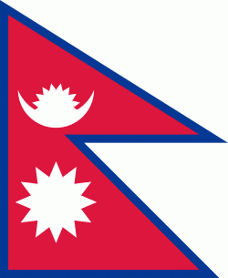
| Flag of Nepal | |
The name "Nepal" is first recorded in texts from the Vedic period of the Indian subcontinent, the era in ancient Nepal when Hinduism was founded, the predominant religion of the country. In the middle of the first millennium BC, Gautama Buddha, the founder of Buddhism, was born in Lumbini in southern Nepal. Parts of northern Nepal were intertwined with the culture of Tibet. The centrally located Kathmandu Valley is intertwined with the culture of Indo-Aryans, and was the seat of the prosperous Newar confederacy known as Nepal Mandala. The Himalayan branch of the ancient Silk Road was dominated by the valley's traders. The cosmopolitan region developed distinct traditional art and architecture. By the 18th century, the Gorkha Kingdom achieved the unification of Nepal. The Shah dynasty established the Kingdom of Nepal and later formed an alliance with the British Empire, under its Rana dynasty of premiers. The country was never colonised but served as a buffer state between Imperial China and British India. Parliamentary democracy was introduced in 1951 but was twice suspended by Nepalese monarchs, in 1960 and 2005. The Nepalese Civil War in the 1990s and early 2000s resulted in the establishment of a secular republic in 2008, ending the world's last Hindu monarchy.
Currency / Language
| ISO | Currency | Symbol | Significant figures |
|---|---|---|---|
| NPR | Nepalese rupee | ₨ | 2 |
| ISO | Language |
|---|---|
| EN | English language |
| NE | Nepali language |